Home › For Architects, Engineers & Contractors
Architects · Engineers · Contractors

Existing conditions, captured in one visit. Files your drafter can open Monday.

Southeast 3D Tours scans existing buildings for design and construction firms across Greenville, Columbia and the rest of South Carolina. One Matterport Pro3 LiDAR capture produces a walkable digital twin, an E57 point cloud, floor plans, and CAD or Revit deliverables — scoped as one flat proposal, from a local operator who shows up himself.

Pro3 LiDAR interior + exterior capture
±1% typical dimensional accuracy
1 business day to a flat proposal
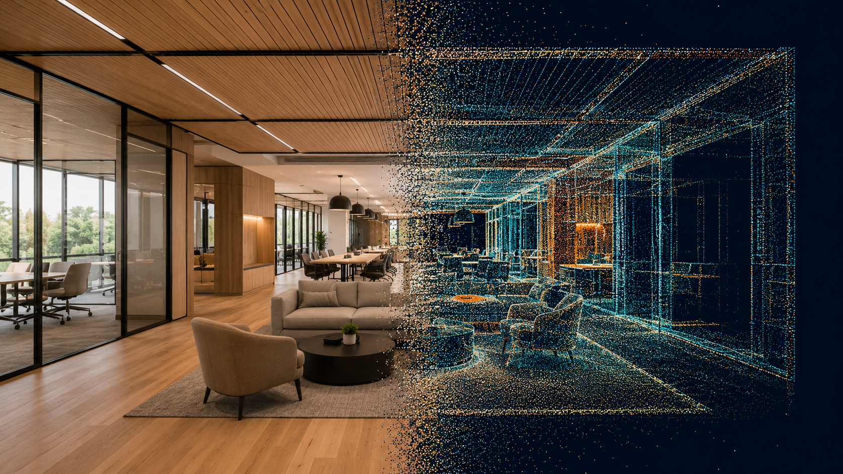
Matterport E57 point cloud alongside the walkable 3D digital twin of the same building

Built for the Way Design and Construction Firms Actually Work

Same capture, different use. Pick your seat.

Architects & Interior Designers

"The as-builts are from 1994 and the walls don't match. We field-measured for two days and still missed the mechanical room."

Start renovation, adaptive reuse, and tenant fit-out projects from verified existing conditions instead of a tape measure and a hope. Walk the building remotely when a question comes up in DD, pull a dimension without a site visit, and hand your drafter a point cloud that drops into Revit or AutoCAD as an underlay.

  • Existing conditions documentation before SD
  • E57 underlay for Revit, AutoCAD, Archicad
  • Remote measurement for RFIs and coordination
  • Historic and adaptive-reuse documentation
  • Code studies and egress review from the model
What architects receive →

Engineers & Facilities Teams

"We need to see what's above the ceiling and route around it, and the owner's drawings stop at the slab."

Document visible MEP, structure, and clearances in context. The digital twin lets your team inspect mechanical rooms, chases, and exposed ceilings without a return trip; the point cloud gives you geometry to route against. We'll be clear about what a visible-surface scan can and can't capture before you commit.

  • Visible MEP and structural documentation
  • Mechanical room and chase capture at higher density
  • Clearance and conflict checks from the model
  • Facilities baseline for capital planning
  • Pre-renovation condition record
Accuracy and limits, plainly →

General Contractors & Builders

"The owner says we damaged it. We say it was like that. Nobody took a picture."

A pre-demolition scan is the cheapest insurance on the job. Progress scans at milestones give the owner remote visibility and give you a time-stamped record for disputes, change orders, and close-out. As-built scans go beyond redlined drawings — the owner gets a measurable model of what was actually built.

  • Pre-demo and pre-construction conditions
  • Milestone progress documentation
  • Pre-drywall capture of in-wall systems
  • Punch list verification without a site walk
  • Close-out as-builts for the owner
Construction documentation in depth →

Deliverables, Formats, Accuracy and Turnaround

Everything below comes from one site visit. Order what you need now; the rest can be produced later from the same capture.

Deliverable Format What you get Opens in Turnaround
Digital twin Web link / iframe Walkable 3D model with dollhouse and floor-plan views, built-in measurement tool, annotation tags, and shareable link. 12 months hosting included. Any browser — no account or software 24–48 hours
E57 point cloud .e57 Vendor-neutral registered point cloud (ASTM E2807) with colorized points and cubemap imagery from every scan position. Full-density export on request. ReCap, AutoCAD, Revit, Archicad, Navisworks, CloudCompare ~48 hours after model finalization
MatterPak™ .obj · .xyz · .png Textured OBJ mesh, XYZ colorized point cloud, reflected ceiling plan image, and high-resolution floor plan image. SketchUp, Rhino, Blender, 3ds Max ~48 hours after model finalization
Schematic floor plan .pdf · .png Dimensioned schematic plan per level with room labels and total area, derived from the scan data. Any PDF viewer 1–2 business days
2D CAD floor plan .dwg Layered architectural floor plan and reflected ceiling plan drawn from the point cloud. Elevations and sections available by scope. AutoCAD, Revit, Archicad, any DWG-compatible CAD Typically 7–10 business days
Revit BIM model .rvt · .ifc Parametric Revit model of walls, floors, ceilings, doors, windows and visible structure, with the linked point cloud. Level of detail agreed per project. Revit, Navisworks, any IFC-compatible BIM tool Typically 7–10 business days
Access spaces Separate model Roofs, attics, crawl spaces, and other areas that don't connect walkably to the main interior, captured as their own model. Same as digital twin With main model
Aerial photography .jpg · .mp4 FAA Part 107 drone stills and video of the site, roof, and context. Interior and exterior from one provider, one visit. Any With main model

Every engagement is quoted as a flat proposal with capture, exports, and any CAD/BIM as separate line items. Square footage is based on your estimate and field-verified from the model. CAD and BIM scope (levels, MEP layers, level of detail) is confirmed before a number is given — send the address and you'll have it within one business day. Autodesk ReCap project files can be provided on request for firms that prefer RCP/RCS over E57.

The Equipment, and What It's Honest About

We capture with the Matterport Pro3 — a LiDAR scanner, not a 360 camera. Here is what that does and doesn't mean for your project.

Matterport Pro3 LiDAR

The Pro3 pairs a LiDAR sensor with a 20-megapixel imaging system, capturing geometry and color at every scan position in about 20 seconds. Unlike earlier structured-light cameras, it works outdoors and in direct sun, handles glass-heavy facades and dark mechanical spaces, and reaches to 100 meters — which is how we capture exteriors, site context, and roofs in the same visit as the interior.

Scan density is tuned to the job. Marketing tours use standard spacing; anything headed for CAD or BIM gets tighter spacing, and mechanical rooms, exposed ceilings, and chases get the densest pass. That's a scoping conversation we have before capture, not an upsell after.

The capture data is retained. If scope grows — the owner decides they want a Revit model six months later — we produce it from the original scan. No return visit, no second mobilization.

Accuracy and limits

✓

Typical accuracy within 1% — about one inch over ten feet. Fit for renovation design, space planning, tenant fit-outs, code studies, preliminary takeoffs, and most as-built documentation.

✓

Visible surfaces, interior and exterior. Walls, floors, ceilings, exposed structure and MEP, facades, and roofs.

✓

Multi-level buildings as one model. Stairs and vertical circulation are scanned to keep levels registered to each other in the point cloud.

✕

Not survey-grade. We do not produce stamped boundary, topographic, or ALTA surveys, and we are not a licensed surveying or engineering firm.

✕

Not for fabrication tolerances. Structural steel detailing, MEP prefabrication, and sub-centimeter work call for a terrestrial laser scanner or targeted field verification. We'll say so upfront.

✕

Can't see through things. Above-ceiling and in-wall systems are captured only where exposed — lift tiles or schedule a pre-drywall pass if you need them.

Recent Work for Design and Construction Clients

A sample of what we've captured for architects, builders, and institutions across South Carolina.

Existing conditions · Architecture firm

University library, Greenwood, SC

Three-level academic library captured interior, exterior, and roof for a Columbia architecture firm's renovation design. Delivered as a registered E57 point cloud plus the hosted model.

~60,000 sq ft · ~1,200 scan positions · 1.5 days on site
Existing conditions · Architecture firm

Multi-tenant commercial building, Orangeburg, SC

Repeat work for the same design firm — a ~20,000 sq ft building scanned as a single registered model for tenant planning and renovation drawings.

~20,000 sq ft · single model · E57 delivered
Campus documentation · Higher education

Furman University, Greenville, SC

Scanned the large majority of the university's published virtual campus tour: student center, dining hall, performing arts center, auditorium, and academic buildings.

Multi-building program · hosted models · public-facing
Remodel survey program · Retail

Multi-site retail remodel surveys, Upstate SC

Standardized interior and exterior condition captures across dozens of retail locations for a national remodel program, delivered to a uniform spec for a corporate design team.

Multi-location program · consistent per-site deliverable

How an AEC Scan Runs

Scoped like a consultant engagement, scheduled like a trade.

1

Scope in one call

Send the address, approximate square footage, levels, and which deliverables you need. You'll have a flat proposal within one business day — capture, exports, and any CAD/BIM as separate line items so your PM can see exactly what's what.

2

Capture

The owner of the company shows up with the Pro3, not a subcontractor. Occupied buildings are fine; we work around people and operations. Roughly 1–2 hours under 3,000 sq ft, 4–8 hours for 10–30k, larger buildings scoped individually.

3

Process and deliver

Digital twin link within 24–48 hours. E57 and MatterPak follow within about 48 hours of model finalization. Floor plans in 1–2 business days. CAD and BIM typically 7–10 business days from scope confirmation.

4

Data stays available

Twelve months of hosting included, then a free transfer to your firm's Matterport account or flat-rate continued hosting. Additional exports can be ordered from the same capture at any time — no revisit.

How We Quote AEC Work

No calculator, no tiers to decode. Send the building, get one flat number.

What drives the price

  • Square footage and levels — capture is scoped per square foot, field-verified from the model
  • Scan density — standard for documentation, tighter where CAD or BIM is headed, densest in mechanical rooms and exposed ceilings
  • Exports — E57, MatterPak, floor plans, each a flat line item
  • CAD / BIM scope — levels, MEP layers, and level of detail agreed before a number is given
  • Access spaces and exteriors — roofs, attics, crawl spaces, site, and aerials as their own lines
  • Travel — one mobilization line; multiple sites on one trip share it

What every proposal includes

  • Capture by the owner with a Matterport Pro3 LiDAR scanner
  • Interactive digital twin with measurement and annotation tools
  • Shareable link and embed code for your team and the owner
  • 12 months of hosting, then free transfer to your firm's account
  • Capture data retained — later exports need no revisit
  • Separate line items so your PM sees exactly what's what

Design firms that scan most projects can ask for a standing rate sheet. Larger engagements are contracted under the Matterport Service Partner 3D Services Agreement.

Request a Proposal

Questions Architects and Contractors Ask

How accurate is a Pro3 scan for existing conditions?

Typically within 1% — about an inch over ten feet. Sufficient for renovation design, space planning, tenant fit-outs, code studies, and most as-builts. Not survey-grade; for steel detailing or MEP fabrication we'll point you to a terrestrial laser scanner or targeted field verification upfront.

What file formats do you deliver?

E57 point clouds (ReCap, AutoCAD, Revit, Archicad, Navisworks, CloudCompare), MatterPak with OBJ and XYZ (SketchUp, Rhino, Blender), PDF/PNG floor plans, DWG 2D CAD, and RVT/IFC BIM models. The digital twin is a link — no software or account needed.

What's the turnaround on an E57?

Digital twin in 24–48 hours; E57 typically within 48 hours after the model is finalized. Floor plans 1–2 business days. CAD and BIM typically 7–10 business days from scope confirmation.

Can we order CAD or BIM later from a scan you already did?

Yes. We retain the capture data, so exports and models can be ordered after the fact with no return visit. That's the main reason design firms scan every project up front.

Do you scan exteriors, roofs, attics and crawl spaces?

Yes. The Pro3 is LiDAR-based and works outdoors, so facades, site context, and roofs are captured in the same visit. Access spaces that don't connect walkably to the interior are scanned as separate models and scoped as their own line item.

Who owns the data, and how long is it hosted?

Twelve months of hosting is included. After that, free transfer to your firm's Matterport account or flat-rate continued hosting. Exported files are yours outright once delivered.

Do you work with firms outside the Upstate?

Yes — we scan regularly for design firms in Columbia and across South Carolina. Travel is a single line item in the proposal, and multi-site trips share one mobilization.

How is this different from a surveyor or a laser scanning firm?

A surveyor produces stamped boundary and topographic surveys; we don't. A TLS firm produces millimeter-grade clouds at several times the cost and on-site time. Pro3 LiDAR capture sits in between: a walkable twin plus an engineer-usable point cloud in one visit, scoped as one flat proposal, for the large majority of work where 1% is enough.

More on the technology: How reality capture works  ·  Point clouds, E57 files and as-builts explained  ·  Glossary

Send the Address. Get a Number Tomorrow.

Square footage, levels, and the deliverables you need — that's all it takes to scope. Request a Proposal or call and talk to the person who'll be on site.

james@southeast3dtours.com

Southeast 3D Tours is a division of Carolina Aerials, LLC — a locally owned, FAA Part 107 certified operation in Travelers Rest, South Carolina. Matterport Service Partner. Interior LiDAR capture and aerial documentation from one provider.