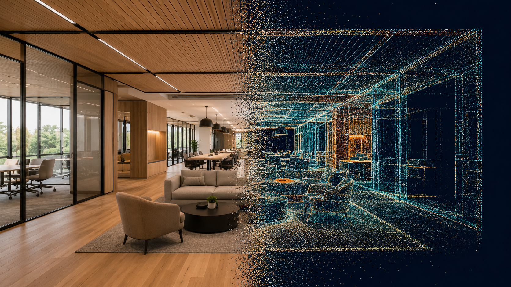
A commercial client recently asked us a question that most Matterport providers never get, because most Matterport providers only sell tours: "Can we get the raw scan data?"
The answer is yes — and if you're an architect, engineer, contractor, or facilities manager, the raw data may be worth more to you than the tour itself. The same scan that produces an interactive 3D walkthrough also produces a measurable point cloud, exportable CAD-ready files, and the foundation for as-built documentation. One site visit, multiple deliverables.
This post explains exactly what data a Matterport scan generates, what each file format is for, who uses it, and — just as important — where Matterport data reaches its limits.
The Short Answer
A single Matterport scan can deliver five categories of output:
- The interactive 3D tour — the marketing and walkthrough product most people know
- The MatterPak Bundle — a colorized point cloud (.xyz), textured 3D mesh (.obj), reflected ceiling plan, and high-resolution floor plan image
- An E57 file — a high-density, vendor-neutral point cloud roughly 10–20x more detailed than the MatterPak's .xyz file, built for CAD and BIM workflows
- CAD files — editable .dwg floor plans and reflected ceiling plans, drafted from the scan data and ready to open in AutoCAD
- Derived documents — schematic floor plans, scan-to-BIM Revit models (.rvt or IFC), and Xactimate-ready TruePlan files for insurance work
The tour is the marketing product. The point cloud is the construction product. Same scan, different buyers.
Key Terms, Defined Plainly
Point cloud: A set of millions of individual measurement points in 3D space, each with X, Y, Z coordinates (and color data). Together they form a measurable digital replica of a building's interior. Think of it as a photograph you can pull dimensions from.
E57: A vendor-neutral point cloud file format defined by the ASTM E2807 standard. Because it's not tied to any one software vendor, an E57 file opens in virtually every professional 3D design application — Autodesk Revit and ReCap, AutoCAD, Archicad, Rhino, Trimble RealWorks, CloudCompare, Leica Cyclone, and others. Matterport offers a free Revit plugin that imports E57 data directly, and SketchUp users can bring E57 point clouds in through Trimble's Scan Essentials extension.
MatterPak Bundle: Matterport's standard data export package: a colorized .xyz point cloud, a textured .obj mesh model, a reflected ceiling plan image, and a high-resolution floor plan image. Suitable for space planning, visualization, and general documentation. The .obj mesh is also the easiest on-ramp for modeling tools like SketchUp, Rhino, 3ds Max, and Blender — import the mesh, trace or model against it, and export in whatever format your workflow needs.
As-built documentation: Drawings or models that record a building as it actually exists — not as it was originally designed. Renovation work, tenant fit-outs, and facilities management all depend on accurate as-builts, and for older buildings the original drawings are often missing or wrong.
Digital twin: The complete, navigable 3D replica of a physical space. The Matterport tour is the visual layer of the digital twin; the point cloud is its measurable skeleton.
Scan-to-BIM: The process of converting point cloud data into a Building Information Model — typically an Autodesk Revit file — that architects and engineers can design against directly. Matterport's BIM deliverable is modeled to LOD 200 (schematic-design fidelity) and includes .dwg CAD files alongside the .rvt model.
CAD file (.dwg): An editable 2D drawing — floor plans and reflected ceiling plans — drafted from the scan's point cloud and delivered in AutoCAD format. For projects that need clean 2D drawings rather than a full 3D model, the CAD file is available as a standalone add-on without ordering BIM. Note the limit: it's a top-down drawing, so it doesn't include elevations or sections.
What Each Deliverable Is Actually For
| Deliverable | Format | Best For |
|---|---|---|
| Interactive 3D tour | Hosted link + embed code | Marketing, remote walkthroughs, stakeholder review |
| MatterPak Bundle | .xyz, .obj, plan images | Space planning, visualization, SketchUp/Rhino modeling |
| E57 point cloud | .e57 | CAD/BIM workflows in Revit, AutoCAD, ReCap |
| CAD files | .dwg | 2D floor plans and reflected ceiling plans in AutoCAD |
| Scan-to-BIM | .rvt or IFC (+ .dwg) | LOD 200 as-built starting model for design teams |
| Schematic floor plans | PDF / image | Listings, leasing, documentation |
| TruePlan | .skx | Xactimate insurance claim workflows |
Architects and designers import the E57 point cloud into Revit, AutoCAD, or Archicad to model existing conditions before starting a renovation or fit-out design. Instead of sending a team out with tape measures and a clipboard for a day, they design against measured reality from day one.
Residential designers and design-build firms working in SketchUp can start from the .obj mesh or bring the point cloud in via Scan Essentials — a fast way to get an accurate existing-conditions model for a kitchen remodel, addition, or whole-house renovation without manual measuring.
General contractors and construction managers use scan data for progress documentation, QA/QC verification, and turnover packages. A scan captured before drywall closes up a wall preserves the exact location of every pipe, duct, and junction box — permanently. We cover this workflow in detail on our construction documentation page.
Facilities and property managers use the floor plan images and mesh files for space planning, lease documentation, and maintenance reference across a portfolio. For a broader look at commercial applications, see our guide to 3D tours for commercial property.
Insurance professionals can order a Matterport TruePlan — an Xactimate-compatible sketch file generated directly from the scan — eliminating manual measuring and sketching during claims work.
We've seen this multi-use pattern firsthand: the commercial documentation scans we perform across the Southeast are rarely about the walkthrough. The client wants the record — the measurable, archivable data underneath it.
Honest Limits: When Matterport Data Is Enough, and When It Isn't
Matterport scans are typically accurate to within about 1% of true dimensions — roughly an inch over a 10-foot span. For the vast majority of use cases (renovation planning, space documentation, as-built reference, facilities management, insurance sketches), that is more than sufficient, at a fraction of the cost of a survey crew.
It is not survey-grade. If your project requires millimeter tolerances — structural steel verification, precision MEP coordination, boundary or elevation surveys — you need terrestrial laser scanning (LiDAR units in the ±2–4mm range) and a licensed surveyor where applicable. We'd rather tell you that up front than sell you data that doesn't fit the job.
A useful rule of thumb: if the deliverable is a reference model, Matterport is usually the most cost-effective capture method available. If the deliverable is a legal or engineering certification, it isn't.
What It Costs
The economics are the best part. Because the data exports come from the same scan as the tour, you're not paying for a second site visit — you're paying for additional processing on data that already exists.
| Item | Price |
|---|---|
| Matterport scan (includes hosted 3D tour) | $0.14 per sq ft, $225 minimum |
| MatterPak Bundle | $150 per property |
| E57 high-density point cloud | $250 per property (delivered within ~48 hours of the scan) |
| Schematic floor plans | $75 |
| CAD files (.dwg floor plans and ceiling plans) | Quoted per project |
| Scan-to-BIM (Revit model + CAD) | Quoted per project by square footage and scope |
For a 10,000 sq ft commercial space, that means a complete digital twin — tour, point cloud, E57, and floor plans — for $1,875 total ($1,400 scan + $150 MatterPak + $250 E57 + $75 floor plans), versus several times that for traditional as-built field measurement. Full pricing details are here.
Frequently Asked Questions
Can you export an E57 from an existing Matterport tour, or does it require a new scan?
If we scanned the property, the E57 can be generated from the existing scan data — no revisit required. This applies to tours we've already delivered.
What software opens an E57 file?
Autodesk Revit (via Matterport's free plugin), ReCap, AutoCAD, Archicad, Rhino, Trimble RealWorks, CloudCompare, Leica Cyclone, and most professional point cloud platforms. E57 is the industry's vendor-neutral standard.
Can I use Matterport scan data in SketchUp?
Yes, two ways: import the .obj mesh from the MatterPak Bundle directly, or bring the E57 point cloud into SketchUp through Trimble's Scan Essentials extension. Either gives you an accurate existing-conditions reference to model against.
Can I get AutoCAD (.dwg) files from a Matterport scan?
Yes. Editable .dwg floor plans and reflected ceiling plans can be produced from the scan data — either as a standalone CAD deliverable or bundled with a BIM order. The .dwg is a 2D top-down drawing; it does not include elevations or sections.
Is Matterport data accurate enough for as-builts?
For reference-grade as-builts — renovation planning, fit-out design, facilities documentation — yes, at roughly 1% dimensional accuracy. For survey-grade or construction-critical tolerances, professional laser scanning is the right tool instead.
What's the difference between the MatterPak point cloud and the E57?
Density. The MatterPak's .xyz point cloud is suitable for visualization and general reference. The E57 contains roughly 10–20x more data points and is built for professional CAD/BIM workflows.
Do I own the data?
Yes. Exported files are yours to keep, archive, and use in any software, independent of the Matterport platform.
The Bottom Line
If you've been thinking of Matterport as a real estate marketing tool, you've been seeing half the product. Every scan we capture generates measurable spatial data that can serve architects, contractors, facilities teams, and insurers — usually for far less than traditional field measurement.
One scan. One site visit. A marketing tour, a measurable point cloud, and permanent as-built documentation.
Southeast 3D Tours provides Matterport scanning with full data exports — E57, MatterPak, CAD (.dwg), floor plans, and scan-to-BIM coordination — across Upstate South Carolina, Western North Carolina, and coastal SC, from our base in the Greenville area. If you have a renovation, documentation, or facilities project and want to know whether reality capture fits it, tell us about the project, start with our reality capture overview, or reach out at james@southeast3dtours.com / 864.351.4255.